


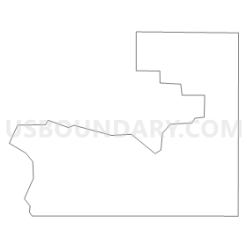
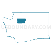
Kayak Voting District, Snohomish County, Washington
About
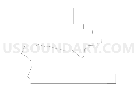
Outline
Summary
| Unique Area Identifier | 688554 |
| Name | Kayak Voting District |
| County | Snohomish County |
| State | Washington |
| Area (square miles) | 3.01 |
| Land Area (square miles) | 3.01 |
| Water Area (square miles) | 0.00 |
| % of Land Area | 99.93 |
| % of Water Area | 0.07 |
| Latitude of the Internal Point | 48.13125230 |
| Longtitude of the Internal Point | -122.33723400 |
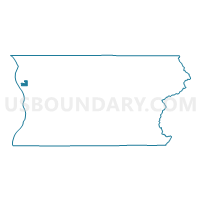
Maps

Graphs
Select a template below for downloading or customizing gragh for Kayak Voting District, Snohomish County, Washington


Neighbors
Neighoring Voting District (by Name) Neighboring Voting District on the Map
- Lake Howard Voting District, Snohomish County, WA
- Mc Rae Voting District, Snohomish County, WA
- Rowland Voting District, Snohomish County, WA
- Shoecraft Voting District, Snohomish County, WA
- Tulalip 1 Voting District, Snohomish County, WA
- Tulalip 4 Voting District, Snohomish County, WA
- Water: Port Susan, Snohomish County, WA
- Water: Possession Sound, Snohomish County, WA
Top 10 Neighboring County Subdivision (by Population) Neighboring County Subdivision on the Map
Top 10 Neighboring Place (by Population) Neighboring Place on the Map
Top 10 Neighboring Unified School District (by Population) Neighboring Unified School District on the Map
- Marysville School District, WA (69,169)
- Stanwood-Camano School District, WA (32,907)
- Lakewood School District, WA (13,926)
Top 10 Neighboring State Legislative District Lower Chamber (by Population) Neighboring State Legislative District Lower Chamber on the Map
Top 10 Neighboring State Legislative District Upper Chamber (by Population) Neighboring State Legislative District Upper Chamber on the Map
Top 10 Neighboring 111th Congressional District (by Population) Neighboring 111th Congressional District on the Map
Top 10 Neighboring Census Tract (by Population) Neighboring Census Tract on the Map
- Census Tract 9400.02, Snohomish County, WA (4,169)
- Census Tract 532.02, Snohomish County, WA (4,167)